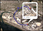
Google has updated its Google Earth product, a satellite-based mapping application, with a Linux version that includes language capabilities in French, Italian, German and Spanish and — perhaps of most interest to its millions of users — a huge influx of new data images.
The application, which has been downloaded an astounding 100 million times, now contains quadruple the number of high-resolution aerial photographs, including images in rural areas of China and Africa.
For Fun and Profit
Google Earth has become a mainstay for developers, city planners, architects and all manner of tourism-related operations, to name just a few of its business uses. At the same time, individuals have rushed to use the application for their own purposes — everything from enriching history sites that show the locations of major battles to tracing the migratory patterns for birds.
Google Earth’s draw is hardly surprising, Matt Booth, program manager for the Kelsey Group, told TechNewsWorld, and the updates are important for its continued popularity.
The addition of Linux support will push out its use to a greater number of people, he noted, as will the increase in the number of images available to users. “Applications like this need to have as many images as possible from as many points in the world — no matter how offbeat,” he remarked.
To be sure, not every corner of the world is available for mapping. Booth tried to find a small Caribbean island, St. John, which wasn’t available. Nearby St. Thomas, though, was present on Google Earth, allowing him to locate a Radio Shack and other local stores on the island.
Connecting the Dots
Another enhancement allows developers of Web sites that merge geographic information with Google Maps to integrate data based on addresses. This ability to geocode addresses using the Google Maps API (application program interface) is the most requested feature from Maps API users, according to Google.
The new version also enables the display of KML (keyhole markup language) — the file format used by Google Earth and otherapplications to share geographic information — on Google Maps. This allows data created in Google Earth to be viewed in a Web browser as a simple mash-up.
Google also announced fee-based licensing and support for businesses wanting to embed Google Maps Web sites or internal applications.
Like many of Google’s other product rollouts, Google Earth provides few discernible clues to the company’s grand scheme. Clearly, though, it serves as one more means to build out its community of users, and hence advertising targets, even further. Google is encouraging developers to extend the product by building plug-ins and other applications on top of it.
“The important piece for Google is to tie this in with other mapping APIs,” Booth said.
To be sure, Google has already begun to leverage its mapping capabilities through links with other products.
In April, for example, it introduced a beta version of its latest productivity tool — an online calendar that allows users to update and share schedules, as well as to access other applications, including Google Earth. This integration allows a user to connect an event that has an address listed to a map to the location.


